OnSite offers an extensive range of survey reporting including Impermeable Area Surveys (or Contributing Area Surveys).
Using a wide variety of monitoring and assessment techniques, including Radio detection, dye tracing and CCTV, OnSite will provide you with hydraulic models demonstrating how a network will perform during periods of rainfall. Where surface water will drain to and what the impacts will be on both the storm and the foul sewer systems. Identifying where foul sewage enters the storm water system and causes pollution to watercourses.
The hydraulic models can be as extensive as the client determines, from the impacts of just the road network, to a complete built-up area impact.
Final data reports can be supplied in most common formats, including STC25 and SUS 25 as well as drawings provided in MapInfo or AutoCAD format.
Survey data is subject to OnSite’s rigorous quality control procedures prior to final report compilation before dispatch to our client.
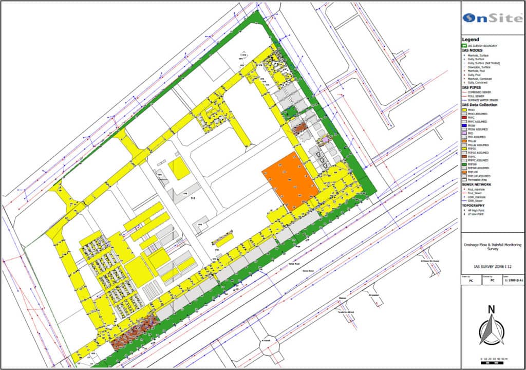
Impermeable Area Surveys
- Identify surface water run-off from hard standing areas
- The impacts on the foul water system
- The impacts on the storm water system
- Where foul water and storm water mix
- Identify the connections between manholes
- Identify the origin of sewage pollution
- Identify the destination of sewage pollution through culverts and watercourses
- Extensive and rigorous reporting